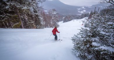
White Mountain National Forest Re-Opens Most Trail Heads
White Mountain National Forest to Open Trailheads
CAMPTON, NH May 1, 2020 – The White Mountain National Forest has re-opened several trail heads that were closed last week. The decision was based on safety concerns due to illegal parking while trailheads were closed, and to alleviate congestion on other locations during a continued demand for local recreation.
The White Mountain National Forest will continue to implement a phase-based opening of the Forest in alignment with the State of New Hampshire. A limited number of sites will remain closed as the Forest continues to coordinate with local communities, the states of New Hampshire and Maine, and partners to address concerns before safely re-opening. A complete list of what is open and what is closed, including those sites still seasonally closed, can be found at: https://www.fs.usda.gov/main/whitemountain/home.
Everyone is urged to take the precautions recommended by the Centers for Disease Control and Prevention (CDC): https://www.cdc.gov/coronavirus/2019-ncov/about/prevention.html. These safety precautions will help to maintain a safe environment for employees, visitors, and local communities. Many amenities, such as restrooms and garbage, at sites remain seasonally closed. Visitors should be prepared to pack in and pack out.
White Mountain National Forest offices remain open virtually to protect the health and safety of employees and members of the public during the COVID-19 outbreak. Customers needing information, permits and maps are encouraged to call Forest Headquarters at: (603) 536-6100, Saco Ranger Station (603) 447-5448, and Androscoggin Ranger Station (603) 466-2713 during regular business hours.
White Mountain National Forest Trail Head Re-Opening
Bold highlighted trailheads are to remain CLOSED
ANDRO CLOSURES
Trailheads:
Albany Notch(ME) Caribou West/Mud Brook(ME) , Direttissima (part of Cutler River Drainage Closure), East Royce/Spruce Hill(ME), Hastings (ME) Starr King (residential location and request from neighbors) Alpine Garden, Great Gulf Wilderness, , Imp, Kilkenny Ridge, Nelson Crag, Nineteen Mile Brook, Pine Mtn./Pine Link, Thompson Falls, Unknown Pond South, Wild River/Basin, York Pond East
Day Use Area:
Dolly Copp Picnic Area (including pavilion rental), Gilead Picnic Area (ME), Glen Ellis Scenic Area, Great Gulf Parking Area
Dispersed Sites:
Gentian Pond Shelter*, Imp Shelter*, Mt. Cabot Cabin, Osgood Tent site*, Rattle River Shelter*, Rogers Ledge Tent site, Trident Col Tent site*, Unknown Pond Tent site, Valley Way Tent site
PEMI CLOSURES
Trailheads: Ammonoosuc Ravine, Beaver Brook (Kinsman)*, Crawford Connector, Smarts Mountain/Dorchester Rd (Lyme)*, Lincoln Woods, Osceola, Welch-Dickey, Zealand (Forest Rd. 16)
Day Use Area: Zealand Picnic Area
Dispersed Sites: Beaver Brook Shelter*, Coppermine Shelter, Eliza Brook Shelter*, Ethan Pond Shelter*, Garfield Ridge Shelter*, Guyot Shelter*, Hexacuba Shelter*, Jeffers Brook Shelter*, Kinsman Pond Shelter*, Liberty Springs Tentsite*, Moose Mountain Shelter*, Ore Hill Tentsite*, Smarts Mountain Cabin and Tentsite*, Three Ponds Shelter, Trapper John Shelter*, Velvet Rocks Shelter
SACO CLOSURES
Trailheads: South Moat Mountain (request to be closed from town) Albany Covered Bridge, Basin, Boulder Loop, Champney Falls, Downes Brook, Liberty/Brook/Bolles, Oliverian Brook, Piper, Royce Mountain, Sawyer Pond (Kanc. Hwy), Sawyer Pond (Upper Sawyer River Rd.), Sawyer River (Kanc. Hwy), Signal Ridge, Weeks Brook, White Ledge, Carter Ledge
Day Use Area: Diana’s Bath (closure supported by town), Mead Base (dwelling), Brickett Place Interpretative Sites, Lower Falls Recreation Site, Rocky Gorge Scenic Area, Russell-Colbath Historic Site, Sabbaday Falls Observation Site,
Dispersed Sites: Nauman Tentsite* Sawyer Pond Shelter and Tentsite, Baldface Shelter, Penacook Shelter, Jim Liberty Cabin, Kearsarge Tower Observation Site, Mt. Carrigan Observation Site
*trailheads to remain closed are Appalachian Trailhead feeders and will stay closed in order to be alignment with AT closures for trail system as whole